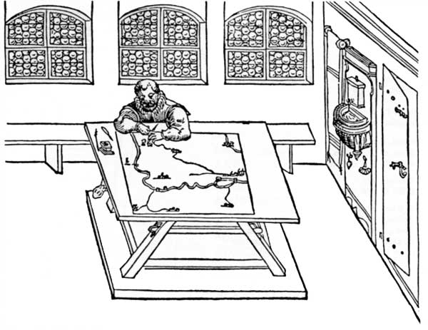
Possibly the earliest woodcut picture of a cartographer at work (Paul Pfintzing, Methodus geometrica, Nürnberg, 1598)
In 1987, a team of three people – Wade Chambers, David Turnbull and Helen Watson-Verran –began a systematic review and critique of the cross-cultural content of teaching materials in the academic field of *Science, Technology and Society*. In this book, one of several publications resulting from that collaboration, David Turnbull analyses maps both as a metaphor for knowledge and also as a major means of knowledge representation in a wide array of cultures. Many of the ideas presented in *Maps Are Territories* relate directly to other books in the *Imagining Nature* series, a list of which may be found on the imprint page. Underlying all books in this series is the conviction that the great nature-culture divide is an illusion, one might almost say, a figment of the Western imagination. In attempting to define our place in the world of nature, we deal not with nature on the one hand and culture on the other but rather with many and various cultural constructions of the natural world. This is really to suggest that nature, in the experience of humanity, is not singular but manifold. Understanding nature, in this larger and more intricate sense, involves close knowledge of relevant cultural traditions. Like the other books in this series, *Maps Are Territories* is conceived and structured not as a linear verbal narrative but as a progression of museum or gallery exhibits designed to exercise the skills of visualisation and visual analysis, so essential to any understanding of the basic theoretical issues of perception and cognition. A portfolio rather than a written text, each book stands alone and may be read without reference to the others. However, the full scope of the argument relating to the cultural dimensions of human perception of the natural environment will become clear only if the books are read in close conjunction. Throughout this period of course re-evaluation, discussions were held with representatives of the Deakin University Koori Teacher Education Project. Both the Koori Teacher Education Project and the Social Studies of Science course team supported the undertaking, with the aim of ensuring that Aboriginal knowledge receive more substantive and serious treatment in the University's curriculum as well as within the general forum of intellectual discussion. The course team also wishes to thank several people who read and made substantive and useful comments on sections of the Imagining nature series: Bruno Latour, John Ziman, Nancy Williams, Barry Butcher, Chris Ryan, John Clendinnen, Kingsley Palmer, Maggie Brady and Andrew Turk. David Wade Chambers 1989

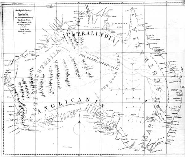
This map of Australia (1827), relatively accurate in its coastal profile, is filled with imaginary mountain ranges, rivers and deltas. Its place names, grid and topographical assumptions derive from European cultural conventions unrelated to the landscape depicted, a landscape which the Aborigines had already mapped in minute and reliable detail.