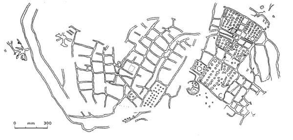
3.1
Bedolina petroglyph, Valcamonica.
Before we attempt to discuss the difference between maps and pictures, we need to look again at the question 'What is a map?'. It is claimed that the Bedolina and Giadighe petroglyphs at Valcamonica (2500 Bc) (ITEMS 3.1 and 3.2), and the wall painting at Çatal Hüyük (6200 Bc) (ITEM 3.3) are amongst the oldest examples of maps. Exactly how old they are is really not important since they are old enough that we have no direct knowledge of the culture in which they were made. What is it that makes it reasonable to claim they are maps? What do we mean when we say they look like maps?
They appear to portray a particular landscape. They have a partly plan-like character, that is, they seem to have a bird's-eye viewpoint. They appear to be only partly iconic, having some symbolic elements with a degree of regularity. We can read the petroglyphs as showing paths, fields, houses and people. Beyond this it is difficult to speculate, since we have no clue as to the purposes of those who drew them. The question of purpose seems crucial, because we would be less willing to call them maps if they clearly had a pictorial, religious, ritual, symbolic or magical function. Yet these different functions need not be incompatible.

3.2
Giadighe petroglyph, Valcamonica.

3.3
Wall painting at Çatal Hüyük.