3.4
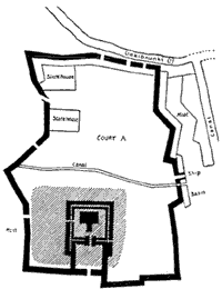
Nippur Plan (1500 BC)

In the case of the two clay tablets from Nippur (1500 BC) and Nuzi (2300 BC) (ITEMS 3.4 and 3.5), though they are of great antiquity, we assume that the cultural continuity and similarities with our own notions of maps are sufficient to identify them as such. They appear to have the clear purpose of representing an identifiable piece of landscape. What features on the tablets would lead to this conclusion?
'What a picture is' is probably one of those deceptively simple questions that philosophy can never answer, but perhaps we can settle on a couple of points. Many pictures are presumably representations of a particular subject or part of the landscape from a particular point of view. The point of view is taken as having at least some significance and may indeed be the dominant aspect of the picture. Whereas maps, though they have a point of view in the sense that they are representations of parts of the landscape, deny or suppress that point of view. This is one of the conventions which we described in Exhibit 2 as 'transparent'. Maps have been thought to be objective in that they are independent of the view of a particular observer. This reveals another of the reasons that theories are held to be analogous to maps:
Theoretical understanding is supposed to disengage us. Theoretical understanding is nonperspectival and therefore treats all locations in space or time as theoretically equivalent (it allows no epistemological privilege to any spatiotemporal framework). Joseph Rouse, Knowledge and power: toward a political philosophy of science, 1987, p.70
However, as we shall see, this notion of maps as non-perspectival representations will not do. It is not just that maps do have a perspective, or that the perspective is taken for granted, it is rather that the disengagement hides the privileging of a particular conceptual scheme. Maps, in this sense, are pictures. They are pictures with different and additional functions and purposes to those of perspectival representation. Pictures may sometimes be entirely subjective, but maps, to be capable of transmitting information, have to be intersubjective.

3.5
Clay tablet from Nuzi (2300 BC)