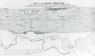
4.2
'Map drawn by Indians on Birch-Bark' (1841). Note the accompanying sketch and note. The note reads: 'Forwarded to the United Service Institution in the hope that it may show young officers how small an effort is needed to acquire that most useful art, Military Sketching, since even Savages can make an intelligible plan.'
It is often argued that maps are scientific and that what makes them so is that they embody, as does science, statements that are true, independent of the context in which they are made (for example, E = MC2). Such statements are called non-indexical. Indexical statements are those that are dependent for their truth on their context. For example, the Chippewa Indian land claim presented to Congress in 1849 (ITEM 4.1) is recogniseably a map, but the information it conveys can only be understood within the cultural specifics of the circumstances that it portrays and cannot be generalised beyond that context. That so-called 'primitive' maps serve specific functions in particular contexts clearly makes them indexical, though ITEM 4.2 rather ironically shows that context boundaries may be transgressed quite readily on occasions. The temptation is to assume that modern projective maps are non-indexical. This would mean both that the position of objects on such a map could be ascertained without reference to a point of view, and that statements about their position could be read directly off the map, without any exposure to the forms of life in which they are embedded. That is to claim that they could be understood independently of their context of use, the world view, cognitive schema or the culture of the mapmaker. In this exhibit, we suggest that this distinction is overdrawn, and that all maps are in some measure indexical, because no map, representation or theory can be independent of a form of life.
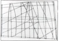

4.3
Stick-charts from the Marshall Islands. The shells represent islands, and the sticks represent currents and lines of swell. Such charts were used for instruction in learning to navigate rather than as navigational aids.
In order to understand why it is that all maps are indexical, let us first consider some examples of early maps: the Marshall Island stick-charts (ITEM 4.3) and the Inuit coastal chart (ITEM 4.4). Without a full understanding of the forms of life in which they are embedded, we cannot read them, though for their makers they provide useful information. Red Sky's migration chart (ITEM 4.5), though distorted and indexical, is clearly readable once we compare it with a Western map (ITEM 4.6). Non Chi Ning Ga's Missouri map (ITEM 4.7) is an American Indian map which differs from a modern map of the same area (ITEM 4.8) only in the details. These examples show that so-called 'primitive' maps are in fact comparable with modern Western maps in many respects.
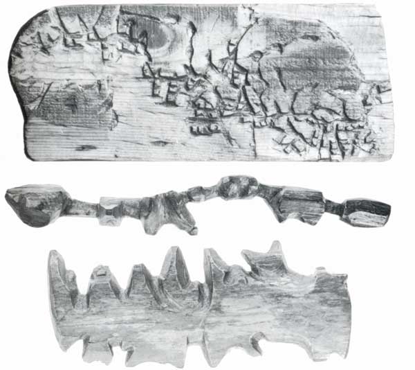
4.4
Carved wooden coastal charts carried in their kayaks by Greenland Inuit (Eskimo). The middle two form a single map: the shorter piece represents a stretch of coast and the larger, islands offshore. Both are read continuously along each side.

4.5
Red Sky's migration chart drawn on a birchbark scroll 2.6 m long. It portrays the migration of the southern Ojibway Indians in mythical times.
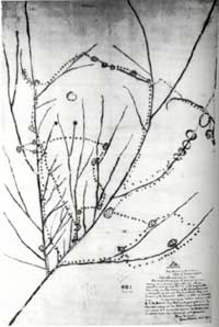
4.7
Manuscript map of the upper Mississippi and lower Missouri presented by Non Chi Ning Ga, an Iowa Indian chief, as part of a land claim in Washington, 1837.
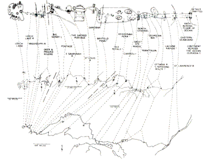
4.6
Contemporary Western geographical interpretation of Red Sky's chart.
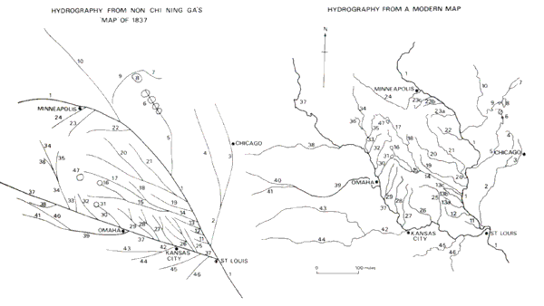
4.8
Contemporary Western interpretation of Non Chi Ning Ga's map.
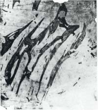
4.9
Pencil drawing of the Belcher Islands by the Inuit Wetalltok.
The ability of indigenous peoples to draw accurate maps is also shown in the example of Wetalltok's map of the Belcher Islands (ITEM 4.9). White explorers of Hudson's Bay were unsure of the existence of the Belcher Islands and were somewhat sceptical of the Inuit claims about them (see ITEM 4.10). They were put on Western maps merely as a matter of guesswork until Wetalltok drew a map of them in 1895. Eventually Flaherty's expedition in 1912-16 established the accuracy of Wetalltok's map of a very complex bit of topography (see ITEM 4.11).
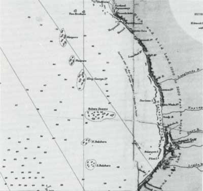
4.10
Map of Hudson Bay and Belcher Islands before Flaherty's expedition (1912-16).
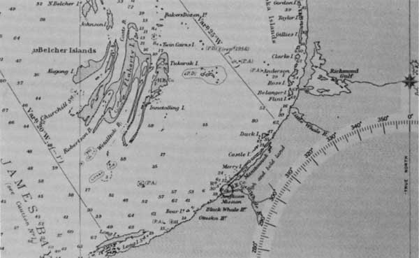
4.11
Map of Belcher Islands after Flaherty's expedition, confirming the accuracy of Wetalltok's map.
It would seem, then, that many apparently 'primitive' maps are just as capable of conveying useful information as are Western maps. So let us now return to the question of whether Western maps are non-indexical by examining the way they structure information using a projective geometry based on a co-ordinate system. The introduction of perspective geometry in Renaissance Europe had a revolutionary impact:
Following the discovery of perspective geometry, the position of man in the cosmos altered. The new technique permitted the world to be measured through proportional comparison. With the aid of the new geometry the relative sizes of different objects could be assessed at a distance for the first time. Distant objects could be reproduced with fidelity, or created to exact specifications in any position in space and then manipulated mathematically. The implications were tremendous. Aristotelian thought had endowed all objects with 'essence', an indivisible, incomparable uniqueness. The position of these objects was, therefore, not to be compared with that of other objects, but only with God, who stood at the centre of the universe. Now, at a stroke, the special relationship between God and every separate object was removed, to be replaced by direct human control over objects existing in the same, measurable space. This control over distance included objects in the sky, where the planets were supposed to roll, intangible and eternal, on their Aristotelian crystal spheres. Now they too might be measured, or even controlled at a distance. Man, with his new geometrical tool, was the measure of all things. The world was now available to standardisation. Everything could be related to the same scale and described in terms of mathematical function instead of merely its philosophical quality. Its activity could also be measured by a common standard, and perhaps be seen to conform to rules other than those of its positional relationship with the rest of nature. There might even be common, standard, measurable laws that governed nature.
James Burke, The day the universe changed, 1985, pp. 76-7